
America’s national parks offer some of the most breathtaking landscapes on the planet, and one of the best ways to experience their grandeur is by car. From winding mountain roads to coastal highways hugging dramatic shorelines, these scenic drives provide accessible adventures for travelers of all abilities.
Whether you’re planning a dedicated road trip or looking to incorporate these routes into a larger vacation, these drives showcase the diverse natural beauty that makes America’s national parks system the envy of the world. Pack your camera, prepare your playlist, and get ready to experience nature’s majesty through your windshield on these unforgettable journeys.
Going-to-the-Sun Road, Glacier National Park

Arguably America’s most famous park road, the 50-mile Going-to-the-Sun Road cuts through the heart of Montana’s Glacier National Park and represents an engineering marvel. Completed in 1932, this narrow two-lane highway hugs mountainsides and crosses the Continental Divide at Logan Pass (6,646 feet), offering heart-stopping views of glacier-carved valleys, alpine meadows bursting with wildflowers, and distant peaks.
Wildlife sightings are common, with mountain goats, bighorn sheep, and even bears frequently spotted from the safety of your vehicle. Due to heavy snowfall, the complete road is typically only open from late June to mid-October, making this a precious seasonal experience that requires some planning.
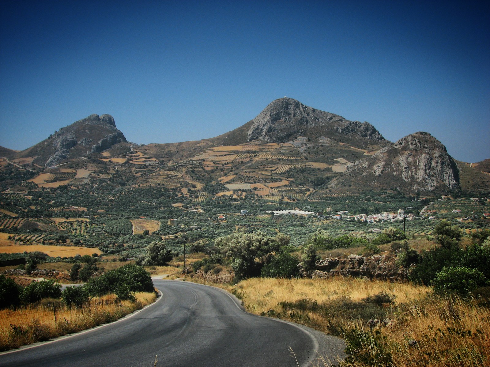
Tioga Road, Yosemite National Park

California’s Yosemite National Park offers multiple scenic drives, but Tioga Road (Highway 120) stands above the rest as it traverses the park’s high country at elevations reaching nearly 10,000 feet. This 47-mile stretch provides access to subalpine meadows, crystal-clear lakes, and granite domes that differ dramatically from the more famous valley floor vistas. Olmsted Point offers one of the most spectacular roadside stops, with panoramic views of Half Dome from an entirely different perspective than most visitors experience.
Tenaya Lake, surrounded by smooth granite formations, provides a perfect picnic spot, while Tuolumne Meadows showcases the largest subalpine meadow in the Sierra Nevada. Like many high-elevation park roads, Tioga is typically only open from late May or June through October or November, depending on snowfall.
Trail Ridge Road, Rocky Mountain National Park

Known as “the highway to the sky,” Trail Ridge Road in Colorado’s Rocky Mountain National Park holds the distinction of being the highest continuous paved road in the United States. Reaching an elevation of 12,183 feet, this 48-mile route connects the towns of Estes Park and Grand Lake while providing travelers with an alpine experience typically reserved for serious hikers. As you climb above the treeline, the landscape transforms into tundra where tiny plants cling to life in an environment so harsh that trees cannot survive.
Numerous pullouts allow visitors to safely observe elk herds, marmots, and spectacular mountain panoramas stretching over 100 miles on clear days. The Alpine Visitor Center, located at 11,796 feet, offers educational exhibits about the fragile tundra ecosystem and stands as the highest visitor center in the National Park System.
Park Loop Road, Acadia National Park

Maine’s Acadia National Park offers a dramatic coastal drive unlike any other in the system with its 27-mile Park Loop Road. This carefully designed route provides access to the park’s most iconic features, including the rocky Atlantic coastline, dense forests, and the summit of Cadillac Mountain. Ocean Drive, a section of the loop, hugs the shoreline where waves crash against pink granite cliffs and cobblestone beaches. Thunder Hole, a natural inlet where trapped air creates thunderous sounds when waves roll in, makes for an exciting roadside stop, especially during high tide.
The road’s one-way sections help manage traffic while ensuring that drivers can safely enjoy the scenery, with numerous pullouts for photography or short hikes. Fall visitors are treated to an additional spectacle as the park’s maple, birch, and oak trees transform the landscape into a tapestry of red, orange, and gold.
Rim Drive, Crater Lake National Park

Circling the caldera of an ancient collapsed volcano, the 33-mile Rim Drive in Oregon’s Crater Lake National Park offers unparalleled views of America’s deepest and perhaps most vibrantly blue lake. Formed approximately 7,700 years ago when Mount Mazama erupted and collapsed, the resulting crater filled with snowmelt and rainwater to create a lake of exceptional purity and color. The road features over 30 overlooks, each offering a different perspective of the 1,943-foot-deep lake and the cinder cone of Wizard Island rising from its surface.
Phantom Ship Overlook provides views of a small island resembling a ghost ship, especially when partially obscured by mist rising from the lake. The road reaches elevations over 7,000 feet and is typically open from July through October, with snow walls sometimes reaching 10 feet high during early summer months.
Badlands Loop Road, Badlands National Park

South Dakota’s Badlands National Park showcases some of America’s most otherworldly landscapes along its 39-mile Badlands Loop Road (Highway 240). This route winds through sharply eroded buttes, pinnacles, and spires formed by the forces of deposition and erosion over millions of years. The layered rock formations display bands of color ranging from deep purples and reds to whites and tans, telling the geological story of ancient seas, rivers, and volcanic ash that once covered the region.
Unlike many park drives that focus on mountains or forests, the Badlands Loop offers expansive views across the prairie where bison herds roam among the rugged formations. Sunrise and sunset are particularly magical times to drive this route, as the changing light dramatically alters the colors and shadows across the landscape. The road connects the Northeast Entrance near the town of Wall with the Pinnacles Entrance near Interior, making it easily accessible as either a destination or a scenic detour off Interstate 90.
Blue Ridge Parkway, Shenandoah National Park to Great Smoky Mountains

Though not contained within a single national park, the Blue Ridge Parkway deserves special recognition as it connects two of America’s most visited parks: Shenandoah and Great Smoky Mountains. This 469-mile “ribbon of road” winds along the crest of the Blue Ridge Mountains through Virginia and North Carolina, offering access to some of the oldest mountains in the world. Nicknamed “America’s Favorite Drive,” the parkway features nearly 300 overlooks showcasing the rolling Appalachian landscapes, with fog often filling the valleys below in ethereal displays that give the Smoky Mountains their name.
Unlike most highways, the Blue Ridge Parkway was designed specifically for leisure travel, with a speed limit of 45 mph or less and commercial traffic prohibited, allowing travelers to fully immerse themselves in the journey. The road reaches its highest point at Richland Balsam (6,053 feet) in North Carolina, where northern forest species create an ecosystem more typical of Canada than the American Southeast.
Pierce Stocking Scenic Drive, Sleeping Bear Dunes National Lakeshore

Michigan’s Sleeping Bear Dunes National Lakeshore features the 7.4-mile Pierce Stocking Scenic Drive, a compact but spectacular route showcasing the diversity of the Lake Michigan shoreline. This carefully engineered loop road takes visitors through beech-maple forests, past massive sand dunes, and to overlooks perched 450 feet above Lake Michigan with views stretching to the Manitou Islands.
The most famous stop, at overlook #9, offers a dune face so steep that many visitors attempt to run down it, only to discover the exhausting climb back up can take up to an hour. Educational signs along the route explain the geological processes that created the dunes and the ongoing environmental changes affecting the landscape. Unlike many national park drives, this route is intentionally designed as a one-way loop with numbered stops, creating an organized, almost museum-like experience of the landscape.
Chain of Craters Road, Hawaii Volcanoes National Park

For a truly unique driving experience, the Chain of Craters Road in Hawaii Volcanoes National Park offers a descent from misty mountain rainforests to the raw edge of volcanic coastline. This 19-mile journey begins near the Kilauea caldera at 4,000 feet elevation and ends where recent lava flows have repeatedly covered the road, creating a dramatic testament to the island’s continuing formation. Along the route, numerous pullouts allow visitors to explore several pit craters, ancient lava tubes, and vast lava fields of various ages, showing different stages of ecological recovery.
The Holei Sea Arch, a 90-foot natural arch carved by waves from a 550-year-old lava flow, marks the road’s end and showcases the constant battle between volcanic creation and oceanic erosion. Unlike mainland park roads that close seasonally for snow, Chain of Craters Road occasionally closes due to active lava flows or dangerous volcanic gas emissions, making each journey potentially different from the last.
Zion-Mount Carmel Highway, Zion National Park

Utah’s Zion National Park features the remarkable Zion-Mount Carmel Highway, a 10-mile engineering marvel completed in 1930 that includes the 1.1-mile Zion-Mount Carmel Tunnel blasted through solid sandstone. This dramatic route connects the main canyon with the park’s east side, climbing through a series of tight switchbacks with sheer drop-offs and panoramic views of colorful sandstone formations.
The Great Arch of Zion, visible from the highway but not accessible by foot, showcases the erosive power of water that has shaped this desert landscape over millions of years. Several pullouts offer opportunities to photograph the contrasting colors of red rock, green vegetation, and blue sky that make Zion one of America’s most visually stunning parks. Larger vehicles require a special permit and traffic control to pass through the historic tunnel, as its dimensions reflect the smaller cars of the era when it was constructed.
Newton B. Drury Scenic Parkway, Redwood National and State Parks

The Newton B. Drury Scenic Parkway offers an intimate 10-mile journey through the heart of California’s old-growth redwood forest in Redwood National and State Parks. This alternative to Highway 101 allows travelers to experience the primeval feeling of driving among the world’s tallest trees, some reaching heights over 350 feet and dating back more than 2,000 years. Unlike many park roads that showcase distant vistas, this drive creates an immersive experience where massive tree trunks line the roadway and filtered sunlight creates an almost cathedral-like atmosphere in the forest.
The Prairie Creek Visitor Center, located along the parkway, provides information about the complex ecosystem that allows these coastal giants to thrive in the unique climate zone where coastal fog provides crucial moisture during dry summer months. Wildlife sightings are common, with Roosevelt elk frequently seen grazing in meadows adjacent to the road, particularly in early morning or evening hours.
Grand Loop Road, Yellowstone National Park

America’s first national park offers the Grand Loop Road, a 142-mile figure-eight route connecting Yellowstone’s most famous features including geysers, hot springs, canyons, waterfalls, and wildlife-rich valleys. This comprehensive drive can be broken into sections or experienced over several days, with each segment offering distinctly different landscapes and attractions. The Lower Loop includes iconic features like Old Faithful, Grand Prismatic Spring, and Yellowstone Lake, while the Upper Loop showcases Mammoth Hot Springs, the Grand Canyon of the Yellowstone, and the wildlife-rich Lamar Valley often called “America’s Serengeti.”
Roadside thermal features provide a constant reminder of the massive volcanic caldera beneath the park, with steam vents, bubbling mud pots, and colorful bacterial mats creating an almost alien landscape. Traffic jams are common, but unlike in cities, these “bison jams” or “bear jams” occur when wildlife cross or linger near the roadway, providing unforgettable encounters with the park’s wild residents.
Embracing America’s Natural Heritage Through Scenic Drives

These magnificent routes represent just a selection of the incredible driving experiences available throughout America’s national parks. From the alpine heights of Rocky Mountain to the coastal drama of Acadia, these roads offer more than just transportation—they provide accessible gateways to some of our nation’s most precious natural treasures.
While nothing compares to stepping out of the car and exploring trails on foot, these scenic drives ensure that visitors of all abilities can experience the breathtaking diversity of America’s landscapes. As you plan your next park adventure, consider incorporating these routes into your itinerary, but remember to check seasonal closures, practice responsible wildlife viewing, and take time to truly absorb the natural wonders that these carefully designed roads were created to showcase.