

In the race against extinction, conservationists have gained a powerful ally from an unexpected quarter: drones. These unmanned aerial vehicles (UAVs) have revolutionized wildlife monitoring, offering unprecedented access to remote habitats while minimizing human disturbance. As climate change accelerates and human activities continue to encroach on natural habitats, endangered species face mounting threats. Traditional monitoring methods often prove inadequate, costly, or excessively invasive. Drones offer a compelling solution, combining cutting-edge technology with conservation needs. From tracking elusive snow leopards in the Himalayas to counting orangutan nests in Borneo’s dense rainforests, drone technology is transforming how we protect and understand Earth’s most vulnerable creatures.
The Evolution of Wildlife Monitoring
Wildlife monitoring has undergone dramatic transformation over the decades, evolving from direct observation and manual tracking to increasingly sophisticated technologies. Before drones, researchers relied primarily on ground surveys, camera traps, radio collars, and satellite imagery – each with significant limitations. Ground surveys disturb animals and pose safety risks to researchers in remote or dangerous terrain. Radio collars require capturing animals, which creates stress and potential injury. Traditional aerial surveys using manned aircraft are expensive, noisy, and sometimes dangerous for the flight crew. Drones represent the next logical step in this evolution, offering a less invasive, more cost-effective alternative that can gather data with unprecedented frequency and detail.
Key Advantages of Drone Technology
Drones deliver multiple advantages that make them particularly suitable for monitoring endangered species. They operate at a fraction of the cost of manned aircraft surveys, allowing for more frequent monitoring on limited conservation budgets. Their ability to fly at lower altitudes provides higher-resolution imagery than satellites while maintaining enough distance to avoid disturbing wildlife. The compact size of many conservation drones allows them to be transported to remote locations where traditional survey equipment would be impractical. Perhaps most importantly, drones can access dangerous or inaccessible habitats – from crocodile-infested wetlands to steep mountain slopes – without placing human researchers at risk, opening new possibilities for data collection in previously understudied ecosystems.
Types of Drones Used in Conservation
Conservation work employs several drone categories, each suited to different monitoring scenarios. Fixed-wing drones, resembling small airplanes, offer longer flight times and greater range, making them ideal for surveying vast territories like savannas or marine environments. Multirotor drones, with their helicopter-like design, provide superior maneuverability and hovering capabilities, allowing for detailed observation of specific animals or habitat features. VTOL (Vertical Take-Off and Landing) models combine advantages of both designs, taking off vertically but transitioning to fixed-wing flight for extended missions. Specialized thermal drones equipped with infrared cameras detect heat signatures, enabling nighttime monitoring or locating animals concealed by dense vegetation. The price range varies dramatically, from consumer-grade models costing a few hundred dollars to sophisticated professional systems exceeding $50,000.
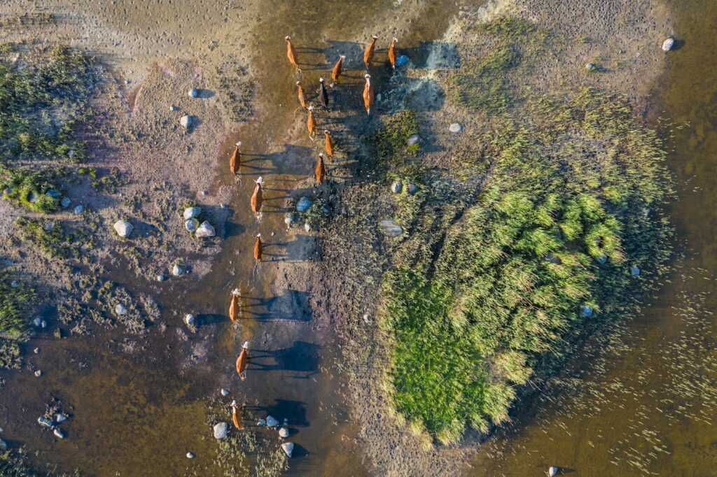
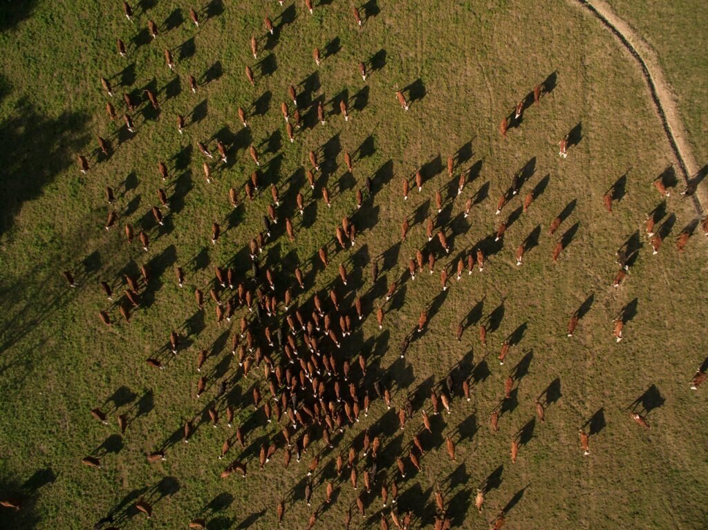
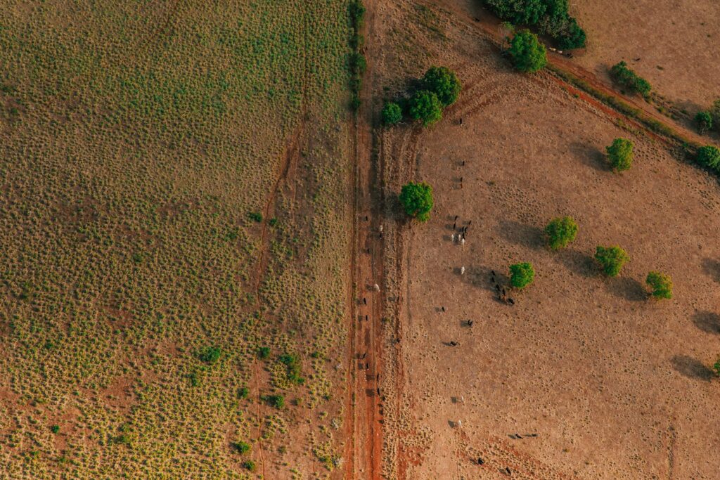
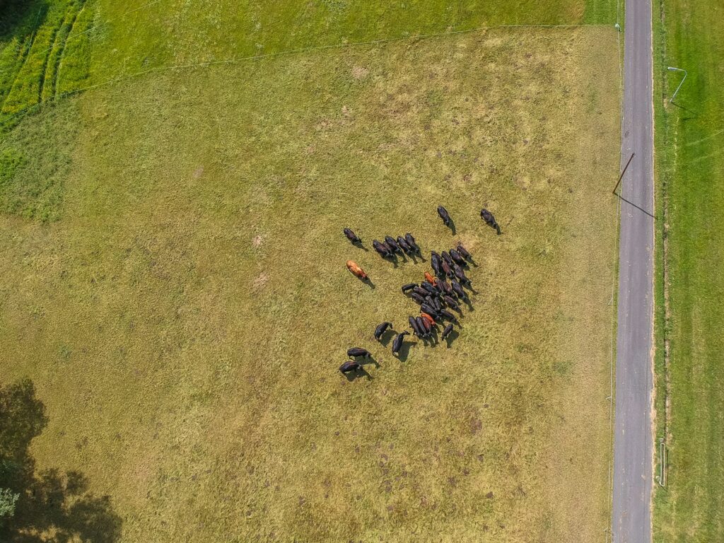
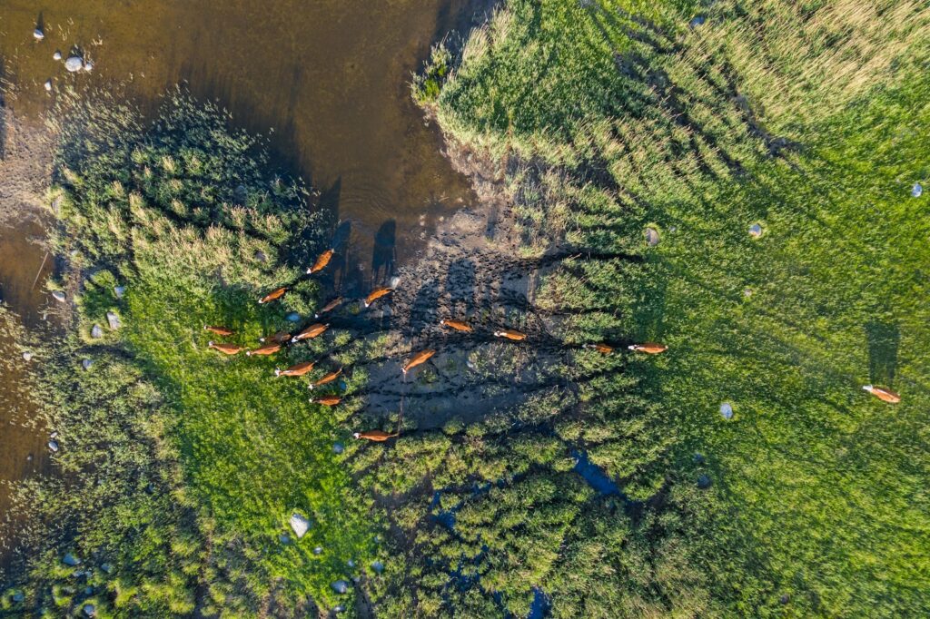
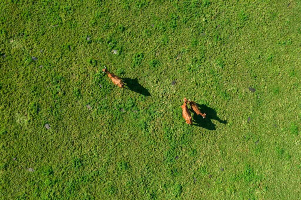
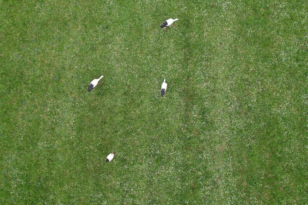
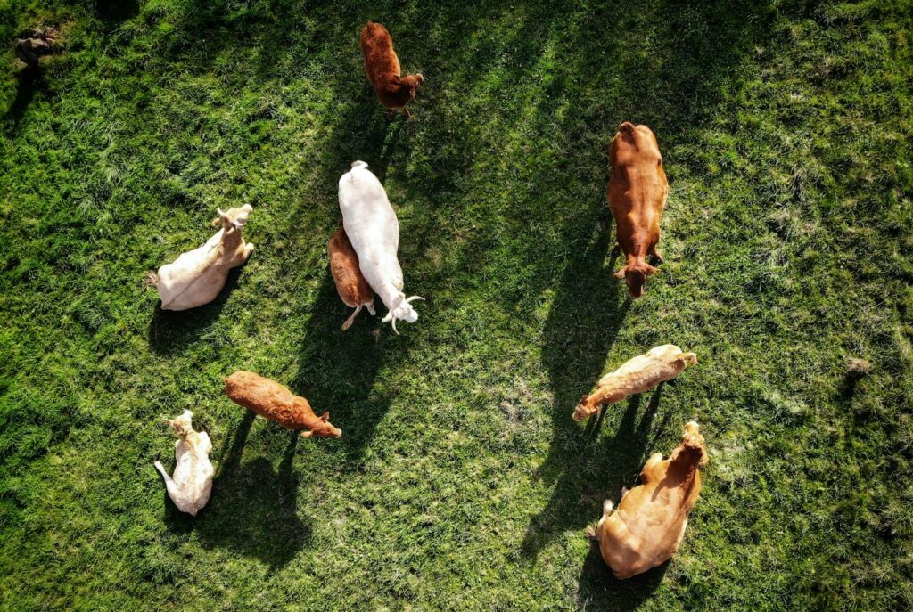
Aerial Population Counts and Monitoring
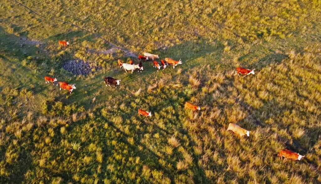
One of the most straightforward applications of drone technology is conducting population counts of endangered species. Traditional counting methods often involve extensive ground surveys or manned aircraft flights, both of which can be prohibitively expensive and logistically challenging. Drones equipped with high-resolution cameras can systematically photograph large areas, creating comprehensive visual records that researchers analyze to count individuals. This approach has proven particularly effective for monitoring herding animals like elephants, rhinos, and certain marine mammals. For example, researchers in Kenya have used drones to conduct elephant censuses in a fraction of the time required for ground surveys, while scientists monitoring southern right whale populations off Argentina’s coast have achieved more accurate counts with significantly reduced disturbance compared to boat-based approaches.
Thermal Imaging for Nocturnal Species
Many endangered species are primarily nocturnal, making traditional visual monitoring challenging or impossible. Thermal imaging drones have emerged as a game-changing solution for tracking these elusive creatures. By detecting heat signatures rather than relying on visible light, these specialized drones can locate warm-blooded animals against cooler backgrounds, even in complete darkness. Conservationists studying orangutans in Borneo use thermal drones to detect nests hidden in dense forest canopy, while researchers tracking endangered Amur tigers in Russia’s far east employ similar technology to locate these solitary predators. The technology has proven particularly valuable for anti-poaching operations, allowing rangers to detect human intruders approaching wildlife reserves at night when most illegal hunting occurs.
AI and Automated Species Recognition
The marriage of drone technology with artificial intelligence has dramatically enhanced the efficiency of wildlife monitoring. Modern conservation drones don’t just collect data; they increasingly help analyze it through automated species recognition. Machine learning algorithms trained on thousands of wildlife images can automatically identify and count animals in drone footage, reducing the hundreds of hours researchers once spent manually reviewing footage. These systems continue improving through use, becoming more accurate as they process more data. The combination proves particularly valuable for monitoring cryptic species that blend into their surroundings, like snow leopards against rocky mountainsides or tigers in tall grass. Organizations like Wildlife Conservation Society and WWF have developed specialized AI models tailored to specific endangered species, dramatically accelerating data processing and allowing near-real-time population assessments.
Habitat Mapping and Assessment

Beyond monitoring animals directly, drones excel at mapping and assessing the habitats critical to endangered species’ survival. Using specialized cameras and sensors, conservation drones can create detailed 3D maps of ecosystems, monitor changes in vegetation cover, and detect signs of habitat degradation or fragmentation. This capability proves invaluable for species whose survival depends on specific habitat conditions, such as the critically endangered vaquita porpoise restricted to Mexico’s Gulf of California. Researchers use drone-generated habitat maps to identify high-priority conservation areas, track habitat recovery after restoration efforts, and document illegal activities like deforestation or wetland drainage that threaten endangered species. By combining these habitat assessments with direct wildlife observations, conservationists develop more comprehensive protection strategies that address both immediate threats to animals and longer-term ecosystem changes.
Anti-Poaching Applications

The illegal wildlife trade threatens numerous endangered species, driving some to the brink of extinction. Drones have emerged as a powerful tool in anti-poaching efforts, particularly in vast protected areas where rangers cannot maintain constant ground presence. Equipped with thermal cameras, drones can patrol wildlife reserves at night, when most poaching occurs, detecting human intruders by their heat signatures. Some conservation organizations have developed systems that combine drone surveillance with AI to distinguish between animals, rangers, and potential poachers, automatically alerting security teams when suspicious activity is detected. In South Africa’s rhino reserves, drone patrols have contributed to significant reductions in poaching incidents by increasing poachers’ risk of detection and capture. Beyond detection, the visible presence of drones serves as a deterrent, with poachers avoiding areas known to employ aerial surveillance.
Marine Conservation Applications
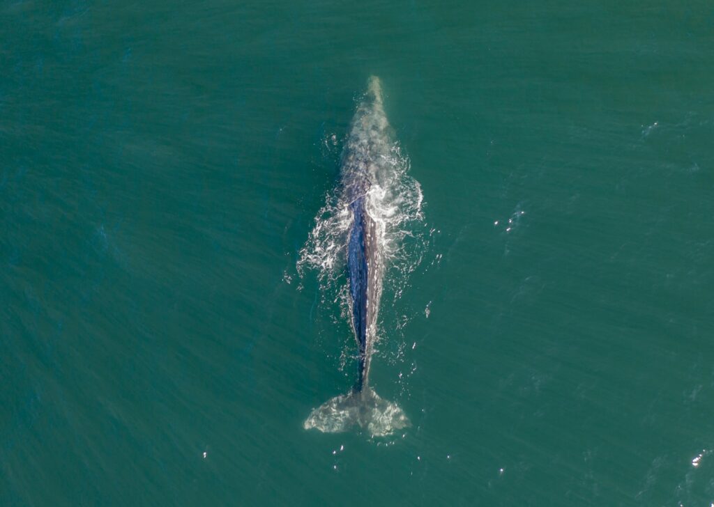
Marine environments present unique monitoring challenges that drones are particularly well-suited to address. Waterproof drones can take off from and land on water, allowing close observation of marine species without the disturbance caused by boat engines. Researchers studying endangered whale populations use drones to collect breath samples (whale “blow”) containing valuable DNA and hormone information without the stress of direct contact. Conservation teams monitoring sea turtle nesting beaches employ drones to count tracks and nests from above, reducing the human foot traffic that might disturb nesting females or damage eggs. In coral reef ecosystems, specialized underwater drones document the condition of endangered coral species and monitor recovery efforts after bleaching events, providing detailed imagery impossible to capture through traditional diving surveys of equivalent scale.
Case Study: Mountain Gorilla Monitoring

Mountain gorillas, found only in the dense forests spanning Rwanda, Uganda, and the Democratic Republic of Congo, exemplify how drone technology adapts to challenging conservation scenarios. Traditional monitoring requires teams of rangers to physically track gorilla families through difficult terrain, potentially stressing the animals and risking disease transmission between humans and these genetically similar primates. Conservation organizations now complement these approaches with carefully planned drone surveys that minimize disturbance while gathering crucial data. Using small, quiet drones with zoom cameras, researchers can observe gorilla groups from a distance that doesn’t trigger stress responses. The technology has proven particularly valuable during civil unrest periods when ground patrols face security risks, ensuring continuous monitoring of this critically endangered species whose population numbers fewer than 1,000 individuals.
Challenges and Limitations
Despite their advantages, conservation drones face significant challenges that limit their effectiveness in certain contexts. Battery limitations restrict flight times, typically to under an hour for most affordable models, complicating surveys of vast territories. Weather conditions severely impact operations, with high winds, heavy rain, or extreme temperatures grounding drones precisely when monitoring might be most needed. Many countries have implemented strict regulations governing drone use, requiring permits that can be difficult for conservation organizations to obtain, particularly in politically sensitive border regions where many endangered species live. The noise generated by drone propellers, while less disruptive than manned aircraft, can still disturb sensitive wildlife, potentially altering behavior or causing stress responses that skew research results. Conservation teams must carefully weigh these limitations against the benefits when designing monitoring programs.
Ethical Considerations
The use of drones in wildlife conservation raises important ethical questions that responsible practitioners must address. Privacy concerns emerge when drones monitoring wildlife inadvertently capture images of local people, particularly indigenous communities whose territories overlap with conservation areas. The potential stress caused to animals by drone presence remains incompletely understood, with some species showing strong aversion to aerial objects that might resemble predators. Conservation organizations must balance the valuable data gained against possible negative impacts on the very species they aim to protect. Best practices have emerged to minimize these concerns, including flying at appropriate heights, using quieter drone models, limiting flight duration over sensitive areas, and engaging local communities in drone program planning and implementation to ensure their perspectives and privacy are respected.
Future Directions in Conservation Drone Technology
Conservation drone technology continues evolving rapidly, with several promising developments on the horizon. Extended battery life represents perhaps the most anticipated advancement, with new lithium-sulfur batteries potentially doubling flight times compared to current lithium-polymer technology. Increasingly sophisticated sensors beyond visual and thermal cameras will expand data collection capabilities, including environmental DNA sampling drones that can collect genetic material from water bodies or air to detect species presence without direct observation. Swarm technology, where multiple drones operate in coordinated patterns, may soon allow simultaneous monitoring of different parts of an ecosystem, creating comprehensive real-time snapshots of wildlife movements and interactions. Perhaps most significantly, increasing miniaturization will produce even smaller, quieter drones that can observe wildlife with minimal disturbance, potentially revolutionizing our understanding of endangered species’ natural behaviors.
Conclusion
Drone technology has transformed from a conservation novelty to an essential tool in the fight to protect endangered species. By providing cost-effective, minimally invasive monitoring capabilities, drones help conservationists gather crucial data that informs protection strategies, anti-poaching efforts, and habitat management decisions. As the technology continues to evolve, incorporating AI, advanced sensors, and improved flight capabilities, its role in wildlife conservation will only grow. However, the most successful conservation programs recognize that drones represent just one component of a comprehensive approach. When combined thoughtfully with traditional field methods, community engagement, and policy advocacy, drone technology offers unprecedented opportunities to understand and protect the planet’s most vulnerable species before they disappear forever.