

In the vast wilderness of America’s national parks, a quiet revolution is taking place. Park rangers who once relied solely on binoculars and tracking skills now deploy sophisticated drones to monitor remote territories. Wildlife biologists exchange handwritten field notes for digital databases that can be analyzed with artificial intelligence. Motion-activated cameras silently record the secret lives of animals that humans rarely glimpse. As visitation to natural spaces increases and climate change alters habitats, national parks face mounting challenges in fulfilling their dual mission of providing public access while protecting fragile ecosystems.
Technology has emerged as a powerful ally in this effort, transforming wildlife conservation from reactive management to proactive protection. From tracking endangered species to deterring poachers, cutting-edge innovations are reshaping how parks safeguard their most precious inhabitants, offering new hope for wildlife preservation in the 21st century.
Satellite Tracking and GPS Collars: Following Wildlife Movements

The days of wondering where animals migrate or establish territories have been revolutionized by satellite tracking technology and GPS collars. In Yellowstone National Park, wildlife biologists outfit wolves and elk with lightweight GPS collars that transmit location data several times daily, creating comprehensive movement maps that were impossible to generate just decades ago. These tracking systems reveal critical information about habitat use, migration corridors, and responses to human development or climate change.
When the famous mountain lion P-22 made his home in Los Angeles’ Griffith Park after crossing two major freeways, his GPS collar provided unprecedented insights into urban wildlife adaptation. Collars now include accelerometers and temperature sensors that monitor animal health and behavior in real-time, allowing rangers to intervene quickly if an animal shows signs of distress or illness.
Camera Traps: Eyes in the Forest
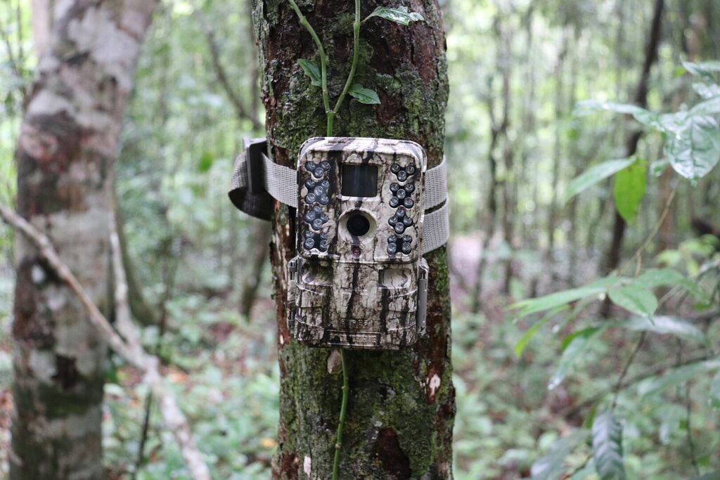
Motion-activated camera traps have transformed wildlife monitoring by providing continuous, non-invasive surveillance in even the most remote park locations. These weatherproof devices capture high-resolution images or video when animals pass by, revealing behavior patterns and population data without human presence disturbing natural activities. In Great Smoky Mountains National Park, networks of camera traps documented the successful recovery of previously declining black bear populations and identified previously unknown habitats for elusive species like fishers and martens.
The technology has become increasingly sophisticated, with some systems now incorporating artificial intelligence to identify species instantly and transmit data to rangers in real-time. Beyond scientific applications, these cameras capture magical moments that inspire public connection to wildlife—like rare glimpses of wolverines in Glacier National Park or the first documented fisher kits born in Washington’s Mount Rainier National Park.
Drones and Aerial Surveillance: Monitoring from Above
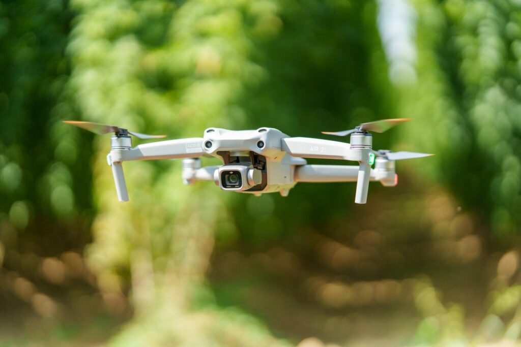
Unmanned aerial vehicles (UAVs) or drones have revolutionized wildlife monitoring by providing cost-effective aerial surveillance capabilities that were once limited to expensive helicopter flights. In Everglades National Park, drones equipped with thermal imaging cameras help biologists locate invasive Burmese pythons hiding in dense vegetation, significantly improving removal efforts of these ecosystem-disrupting predators. Parks with vast, remote territories like Death Valley and Grand Canyon deploy drones to conduct wildlife population surveys, tracking desert bighorn sheep and other species across inaccessible terrain.
The technology proves particularly valuable during natural disasters, as demonstrated when Yosemite rangers used drones to monitor wildlife displacement during the 2018 Ferguson Fire, identifying animals trapped by fire lines and guiding rescue efforts. Enhanced drone capabilities now include sophisticated sensors that can assess vegetation health, water quality, and even detect signs of poaching or unauthorized human activity in protected areas.
Artificial Intelligence and Machine Learning: Processing Big Data

The explosion of data collected through various wildlife monitoring technologies created a new challenge: how to efficiently analyze millions of images, sound recordings, and tracking points. Artificial intelligence and machine learning algorithms now help park scientists process this information at unprecedented speeds. The National Park Service’s “Candid Critters” program uses AI to sort through millions of camera trap images, automatically identifying species with accuracy rates approaching 98% on common animals.
In Denali National Park, machine learning algorithms analyze decades of wolf pack movement data to identify patterns and predict potential human-wildlife conflict zones before problems arise. These technologies also enhance the visitor experience through applications like “Seek” by iNaturalist, which uses image recognition to help park visitors identify plants and animals they encounter on trails. As AI systems improve, they increasingly help identify subtle behavioral changes in wildlife populations that might indicate emerging conservation concerns before they become crises.
Acoustic Monitoring: Listening to the Wild

Sound recording technology has opened a new dimension in wildlife monitoring by capturing the acoustic signatures of ecosystems. The National Park Service’s Natural Sounds and Night Skies Division deploys automated recording units throughout parks to document animal vocalizations, creating an acoustic baseline for each ecosystem. In Olympic National Park, underwater hydrophones monitor the vocalizations of endangered orcas, helping rangers understand how underwater noise pollution from boats affects their communication and hunting behaviors.
Machine learning algorithms now scan thousands of hours of recordings to identify specific species—from the distinctive calls of birds to the ultrasonic echolocation of bats—allowing scientists to track biodiversity changes over time without physical observation. These acoustic monitoring systems have proven particularly valuable for nocturnal species and those that inhabit dense forests or underwater environments where visual observation proves challenging.
Environmental DNA (eDNA): Finding Wildlife Without Seeing It

One of the most revolutionary wildlife monitoring technologies doesn’t require seeing or hearing animals at all—instead, it detects the DNA they leave behind in the environment. Environmental DNA (eDNA) sampling involves collecting water, soil, or air samples and analyzing them for traces of genetic material shed by organisms. In Acadia National Park, scientists use eDNA from stream samples to monitor for the presence of invasive fish species before they become established enough to be visually detected.
Great Smoky Mountains National Park employs eDNA techniques to track the distribution of endangered hellbender salamanders, a cryptic species that spends most of its life hidden under rocks in fast-flowing streams. This technology proves particularly valuable for aquatic environments, where traditional survey methods might miss rare or elusive species entirely. The sensitivity of eDNA analysis continues to improve, with newer techniques capable of determining not just presence but relative abundance of species in an ecosystem.
Anti-Poaching Technology: The Digital Shield

While most national parks in the United States face relatively low poaching pressure compared to international parks, technological anti-poaching tools still play an important role in wildlife protection. Seismic sensors buried along remote park boundaries can detect human intrusion into protected areas, alerting rangers to potential poaching activities in real-time. Thermal cameras mounted on observation towers can spot human movement at night in sensitive wildlife areas, particularly useful in parks with endangered species like desert tortoises in Joshua Tree National Park.
In partnership with conservation technology organizations, some parks deploy sophisticated listening devices that can distinguish gunshots from other sounds and immediately triangulate their location. The most advanced systems integrate multiple technologies—from acoustic sensors to AI-powered cameras—creating a digital shield around vulnerable wildlife populations that significantly extends the reach of limited ranger personnel.
Wildlife Crossing Structures: Smart Infrastructure

Technology isn’t limited to monitoring wildlife—it also creates safer passage for animals across an increasingly fragmented landscape. Wildlife crossing structures incorporate advanced design elements informed by tracking data to help animals safely navigate across roads and human development. Banff National Park in Canada pioneered many of these technologies with its system of wildlife overpasses and underpasses, which have reduced wildlife-vehicle collisions by over 80% and are studied by U.S. national park managers.
These structures now incorporate “smart” elements like infrared cameras that monitor usage patterns and motion-triggered warning systems that alert drivers when animals approach roadways. Data from GPS-collared animals helps planners determine optimal locations for these crossings by identifying natural movement corridors. The newest crossing technologies include embedded sensors that collect data on which species use the structures and how frequently, allowing for continuous improvement in design and placement.
Remote Sensing and Habitat Monitoring

Satellite technology and remote sensing tools allow park managers to monitor habitat conditions across vast landscapes without setting foot on the ground. High-resolution satellite imagery provides regular updates on vegetation health, snowpack levels, and water resources that directly impact wildlife populations throughout national parks. In Everglades National Park, remote sensing technology tracks water levels and quality to ensure optimal conditions for endangered species like the Florida panther and American crocodile. LiDAR (Light Detection and Ranging) technology uses laser pulses to create detailed three-dimensional maps of forest structure, helping managers understand habitat quality for species that depend on specific vegetation characteristics.
During wildfire events, thermal imaging satellites help track fire progression and identify wildlife refugia—areas where animals can find temporary shelter from flames. This bird’s-eye perspective proves invaluable for understanding landscape-level changes that affect wildlife across entire ecosystems.
Citizen Science and Crowdsourced Data Collection
Technology has democratized wildlife monitoring by enabling visitors to contribute meaningful scientific data through citizen science initiatives. Mobile applications like iNaturalist transform casual wildlife observations into valuable research data, with park visitors submitting geo-tagged photos that professional scientists can verify and incorporate into biodiversity databases. The Great Smoky Mountains National Park’s “Adopt-A-Plot” program equips volunteer citizen scientists with standardized monitoring tools and mobile apps to collect long-term data on plant and animal communities throughout the park.
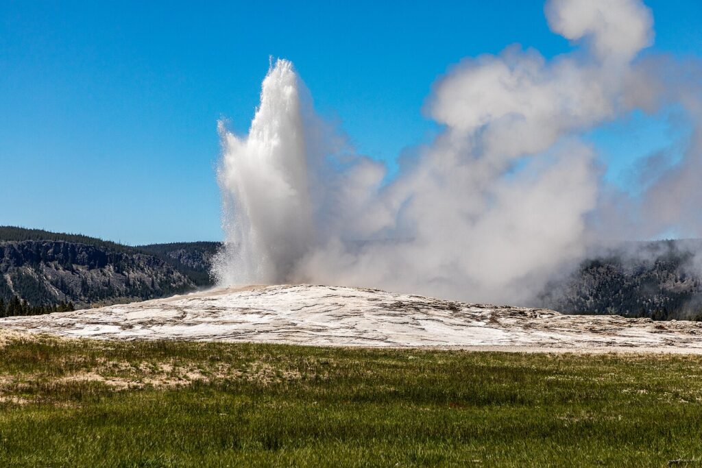
At Yellowstone, the “Old Faithful Geyser” app allows visitors to report wildlife sightings, creating a real-time distribution map that helps both researchers and other visitors understand animal movements. These technological platforms transform millions of annual park visitors from potential disturbances into a distributed network of data collectors, vastly expanding monitoring capacity beyond what professional staff could achieve alone.
Virtual Fencing and Wildlife Management
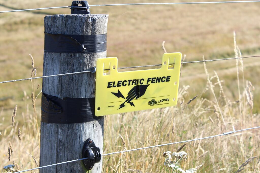
Traditional physical barriers are giving way to more sophisticated and less visually intrusive wildlife management technologies. Virtual fencing uses combinations of signals—often sounds, vibrations, or lights—to deter wildlife from entering dangerous areas without physically blocking their movement. In Rocky Mountain National Park, experimental virtual fence systems emit warning sounds when elk approach roadways, reducing vehicle collisions while maintaining the park’s open aesthetic.
More sophisticated systems use GPS collars that deliver mild corrective stimuli when animals approach designated boundaries, effectively creating invisible fences that can be adjusted seasonally as needed. This technology proves particularly valuable for managing bison in Yellowstone, helping keep them away from areas of potential conflict with humans or domestic livestock while still allowing natural movement patterns. Unlike physical barriers, these systems can be quickly reconfigured as management needs change or as animals adapt their behaviors.
Predictive Analytics: Forecasting Wildlife Challenges
Perhaps the most powerful application of technology in wildlife protection comes from combining multiple data streams to predict and prevent problems before they occur. Predictive analytics systems integrate historical wildlife data with real-time monitoring and environmental factors to forecast potential issues. In Glacier National Park, a predictive model combines bear tracking data with visitor use patterns and seasonal food availability to identify high-risk areas for bear-human encounters, allowing preemptive trail closures or increased ranger presence.
Similar systems help Everglades managers predict python locations based on weather patterns and previous capture data, making removal efforts more efficient. During drought conditions, predictive tools help Death Valley rangers identify water sources likely to dry up, allowing them to install temporary wildlife water stations before animals suffer. By shifting from reactive to proactive management, these technologies prevent wildlife suffering and reduce emergency interventions that might otherwise disturb natural behaviors.
Balancing Technology and Wilderness Values
While technology offers powerful conservation tools, its implementation in national parks raises important philosophical questions about wilderness management. Park managers must carefully balance the benefits of high-tech monitoring with the potential disruption to visitors’ wilderness experience and the animals themselves. In designated wilderness areas within parks, regulations often limit the use of mechanical devices, creating tension between conservation needs and wilderness preservation values.
Grand Canyon National Park addresses this challenge by concentrating technology in high-use corridors while maintaining tech-free zones in backcountry areas. Wildlife biologists design monitoring systems with minimal invasiveness—using camouflaged cameras, remotely deployed sensors, and technologies that don’t require frequent maintenance visits. The Park Service increasingly involves the public in discussions about appropriate technology use, recognizing that while GPS collars and drones might enhance protection, they also transform our relationship with wild animals and places in profound ways.
The Future of Wildlife Technology in National Parks
The future promises even more sophisticated technologies for wildlife protection in our national parks. Emerging biometric identification systems can recognize individual animals by their unique features—like the stripe patterns on tigers or facial characteristics of primates—enabling non-invasive monitoring without the need for tagging. Advances in miniaturization will likely produce increasingly smaller tracking devices that can monitor even small birds and insects without affecting their behavior. Environmental DNA technology continues to evolve toward real-time monitoring systems that could continuously sample water or air for traces of rare or invasive species.
As climate change accelerates habitat shifts, predictive modeling will become increasingly vital for anticipating wildlife needs and guiding adaptive management strategies. Perhaps most importantly, technological systems will become more integrated, with information flowing seamlessly between different monitoring platforms to create comprehensive wildlife protection networks that extend beyond park boundaries to address conservation at ecosystem scales.
Conclusion
The technological revolution in wildlife protection represents a pivotal evolution in how national parks fulfill their conservation mission. From the depths of remote backcountry to the edges where wilderness meets civilization, these innovations extend the reach and effectiveness of limited conservation resources. While traditional field skills remain irreplaceable, technology amplifies human capability to understand and protect wildlife in increasingly complex environments.
As parks face growing pressures from climate change, habitat fragmentation, and increasing visitation, these tools offer hope that America’s iconic wildlife species will continue to thrive in protected landscapes. The challenge moving forward lies not in developing more technology, but in deploying it thoughtfully—in ways that strengthen rather than diminish the wildness that makes national parks so precious. When balanced with wilderness values and traditional conservation approaches, technology becomes not just a collection of sophisticated tools, but a pathway toward a future where humans and wildlife can coexist in these treasured landscapes.